At Grand Canyon National Park we met Windy Bunn, the park’s fire ecologist along with Eric Gdula, the Fire GIS specialist, Li Brannifors, a recent visitor to Australia, and lead of the Fire Effects Team, also Christina, an intern working on collating and analysing weather data in the park for the summer.
Windy explained how the park is split into the management units of the north and south rim for fire management purposes. Fires that ignite inside the rim are not usually responded to due to low fuels, difficult access and low risk. She showed us how fire frequency is mapped over fire history to help inform planning for prescribed burning and to consider old burns for fire advantages in the case of managing wildfires.

 |
| Fire Return or Fire Frequency |
We went out in the field to see how the fire management team ground-truth Landsat images (maps) of fire intensity. A visual assessment is conducted after fires to calibrate the imagery produced by Landsat at a resolution of 30m pixels across the country. Actual fire severity is rated at a number of plots across each fire including planned and unplanned fires and is compared with the Landsat data, via a Trimble hand held tablet in the field. A proforma has been developed that qualitatively rates the post fire effects in the understory and overstory in a circular plot with a 15m radius. Assessment data is collected via the tablet and uploaded upon return to the office. Once there is confidence in the severity data, the Landsat image of the whole fire is recalibrated accordingly and a map produced that is used to inform planning for prescribed burning as well as identifying strategic advantages (areas of high severity) for controlling wildfires. The method has already proved successful assisting to control wildfires in the park.
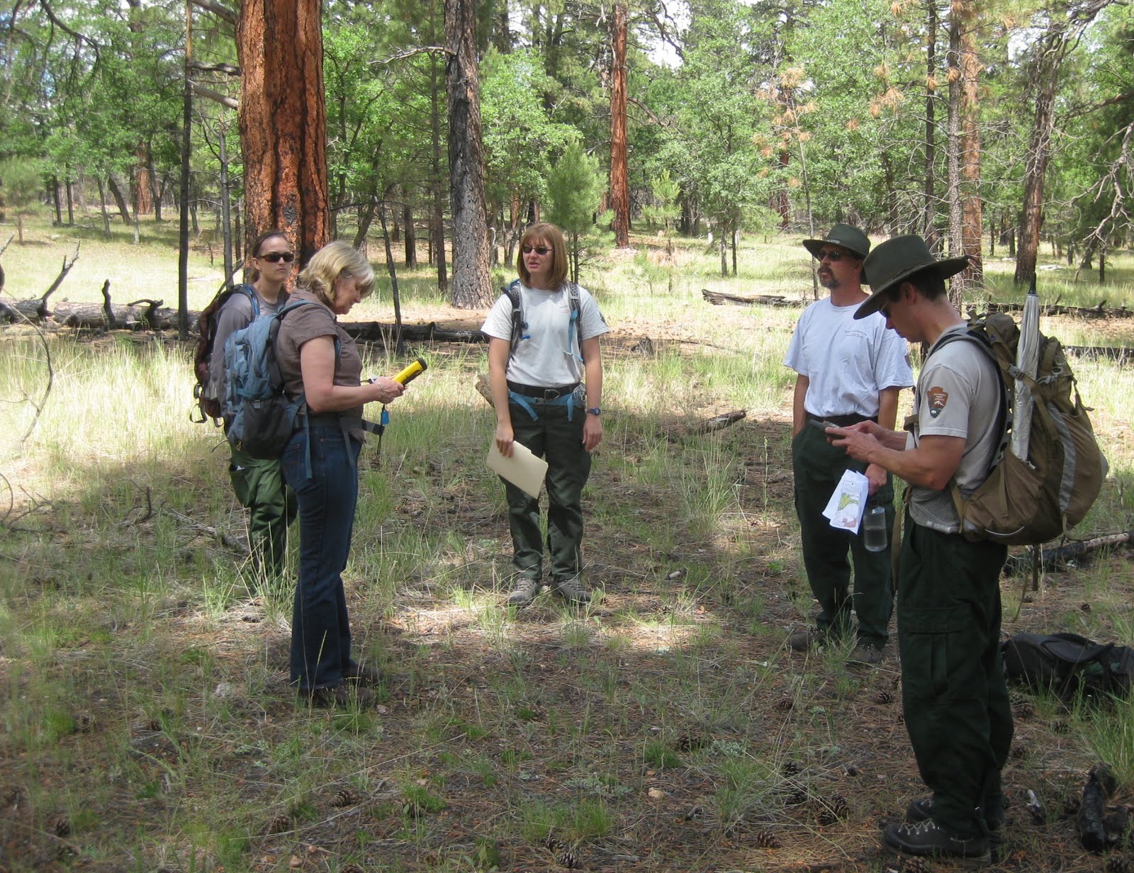 |
| Christina, me, Windy Bunn, Eric Gdula & Li Branifors ground truthing of Landsat imagery of fire severity |

 |
| Fire severity mapping |
Another map product that is produced at the Grand Canyon is a sensitivity map that helps inform planning for wildfires and prescribed treatments by identifying and mapping sensitive areas. These include archaeological sites – prioritised into high, moderate and low importance and areas that have been surveyed for archaeology (with nothing found), flora and fauna species that require special consideration, air quality stations (that they do mechanical treatments around) and research plots that need to have fire excluded.
Challenges for the Grand Canyon Team include considering the 5 or so million visitors they welcome into the park per annum, and the treatments around the Grand Canyon Village and park assets including historic buildings. Fuels in areas close to and within the village are hand cut and piled, then burnt during the winter.
 |
| Piles from mechanical hazard reduction - waiting for winter to burn |
Christina, the summer intern was working on an interesting project assisting staff in the Regional office by collating weather data collected during prescribed burning and wildfire events so that it can be matched with fire behaviour records and success or failure of treatment or suppression activities. The resulting analysis will inform a set of weather prescriptions that are best for conducting burning, or conditions when wildfire can or cannot be controlled. A fascinating idea!
 |
| Smokey and me just outside the park in Coconino National Forest |