Measuring bushfire fuels is important to many different people for so many different reasons;

Calculating the likely success of first attack; prioritising fuel reduction treatments; figuring out optimum fire frequency; calculating fuel accumulation rates; assessing risks and hazards; measuring carbon release; estimating smoke production (to name a few).

This project poses questions to those interested in fire fuels: Why collect fuels data? What do we seek to learn from fuels data? Should we collect fuels data across Australia in a uniform way? How would we store the information? What are the gaps in the knowledge about fuels? and more...

Wednesday, July 27, 2011

Grand ideas find fertile ground at the Tetons

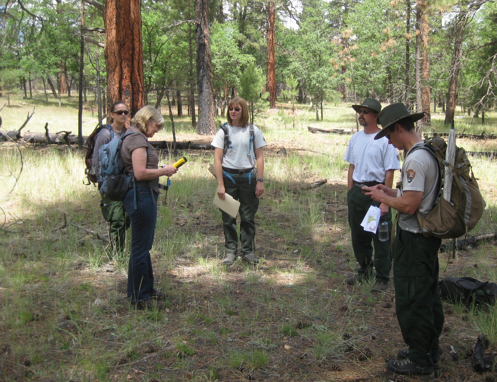
In western Wyoming we met up with Diane Abendroth, Fire Ecologist and Ron Steffens, Fire Monitor who both work as part of Teton Interagency Fire, which brings together the Grand Teton National Park and the Bridger Teton National Forest for co-operative fire management.

Diane explained that the Fire Monitoring Handbook (FMH) was developed in the western parks in the late 1980’s and early 1990’s and was subsequently applied to parks across the country. The fuel sampling methodology however, was designed around the large charismatic mega trees and was much more applicable for those western parks than as a one size fits all monitoring approach. As Dianne commented - “You ride the horse you are feeding".

Over time it became apparent that it would be more appropriate to design fuel sampling around locally specific requirements and questions. As a result custom iterations of the Fuel Monitoring Handbook plots have been developed at the local level to take account of individual ecosystems. The bespoke plot methodology can then be used, for example, to analyse if the objectives of a particular prescribed fire were met, or perhaps to look at the regeneration of particular plants after fire.

Some of the monitoring plots are permanent, however most are set up as temporary or random plots. Naturally the sites locations are recorded with a GPS and can be re-visited if necessary. The methodology applied is less comprehensive and time consuming to set up and read (monitor) than the FMH plots. This means more plots can be established and read to provide a more robust statistical sample size. The data collected are generally quantitative although some of the plots employ qualitative assessment as with the Burn Severity Composite Burn Index that rates post fire effects (as in Grand Canyon NP) to calibrate the Landsat Fire Severity imagery. The main point was that the focus is only on collecting the data required.

The next day Diane and Ron took me for a hike through a burnt area that had partly experienced two fires in close succession. It was fascinating to see the regeneration and the relatively slow rate of re-accumulation of fuels compared with home.  I especially enjoyed hiking the back-country in such a beautiful national park on such a spectacular day. The Tetons towered overhead as elk called and wandered close by. Just brilliant!
The Tetons

regeneration of the forest


elk
Diane & Ron

Thanks Diane and Ron!    


Monday, July 25, 2011

Hi Tech in the Desert

Linda Wadleigh took me out to the Verde Valley to meet up with the Prescribed Fire & Fuels Specialist Scott Spleiss, the Forest Ranger Celeste Gordon, along with Ed Paul, Bucky Yowell and Corey Carlson who work together on fuels management, prescribed and wildfire in the Prescott and Coconino National Forests. As in many of the forests in this part of the country, there is a program to reintroduce fire into the vegetation communities to reinvigorate the forests, promote habitat as well as protect local communities from destructive fires.

Masticated fuels

Mineral earth break created by dragging a hunk of iron behind a  4 wheeler (quad bike)


The Natural Fuels Photo Series is used to estimate fuel loadings with photo points being used to monitor fuels, as well fuel moisture sampling to determine timing for burning. Scott demonstrated the Computrak Moisture Analyzer. Fuels are collected onsite in the forests at temporary sites within planned burn locations and stored in lidded cans for transport. To maintain the temperature and to ensure the fuels do not transpire the cans are kept in coolers until returning to the office for the analysis. The Computrak works by weighing the material then drying it and reweighing to give the fuel moisture content. It’s fast and only takes about 5 minutes to process one sample. The unit cost of the machine is quite expensive though at around $8,000 USD.
Computrak Moisture Analyzer

the dried fuels

readout of the Computrak

Prescribed burning in these forests is conducted on a broad scale at approximately 3,000 – 5,000 acres (1200 – 2000 ha) sized treatment blocks on average. Sometimes sections of the burn blocks are open ended with landscape features, or previously burnt areas or diurnal weather conditions being used to pull up a fire.

The Forest Service employs contractors to masticate fuels near settlements and assets such as camping areas to reduce fuels and prepare the boundaries of burn blocks. Prior to lighting up briefings are held in the conference room at the Verde Valley Center using Google Earth to fly over and familiarize crews with the topography of the blocks to be burnt. Google Earth is also used to brief management on the prescribed burning program to be undertaken for the year. Before we went out in the field Scott used Google Earth to show me where the field inspection was planned as well as explaining previous burn history and nearby assets and communities at risk. It was an excellent tool and a brilliant way to easily convey topographical information.

Linda Wadleigh, Smokey, and me


Thanks Linda, Scott, Celeste, Ed, Bucky & Corey!


Sunday, July 24, 2011

Just how Dry is that Fuel?


In Flagstaff we caught up with Linda Wadleigh a fire ecologist from the US Forest Service who introduced us to Wesley Hall who works on fuels for the Coconino National Forest.  Wes told us about how live fuel moisture sampling is conducted in the forest at permanent sites to guide timing for prescribed burning. The fuel moisture readings indicate when fuels are ready to burn in a controlled manner, as well as assisting in calculating how much fuel will be consumed during prescribed burning for emissions reporting. Fuel moistures can also be used predict wildfire behaviour.


Moisture in the 1000 hour fuel category (larger than 3 inches) is measured by placing sticks or small poles on the permanent sites. The sticks are allowed to acclimatise, then are cored every 15 days, with the sawdust being dried in a Computrac moisture analyzer. The moisture analyzer is a device from Arizona Instruments that was developed for measuring moisture in compounds such as chemicals and concrete and has been applied to measuring live fuel moisture. The fuels data collected by the US Forest Service is routinely contributed to the National Fuels Moisture Database.
me, Wes and Linda check out the fuels monitoring
1000 hour fuels - cored regularly to measure moisture

Wes and Linda took us out to check out the Remote Area Weather Station (RAWS) in the Coconino National Forest just outside Flagstaff. Aside from collecting the usual weather data, the RAWS monitors the moisture of 10 hour fuels (1/4 -1 inch in diameter) remotely using a probe. RAWS units collect, store and forward data to a computer system at the National Interagency Fire Center (NIFC) in Boise, Idaho, via a satellite. The data is automatically forwarded to several other computer systems including the Weather Information Management  System (WIMS) and the Western Regional Climate Center in Reno, Nevada.  
RAWS
10 hour fuels moisture collected by the RAWS

Linda showed us the Wildland Fire Decision Support System or WFDSS (pronounced “wiffdus”); a software tool available to fire managers in this country.  WFDSS is a set of modules that assist fire managers to predict fire behaviour as well as helping to guide tactical and strategic decisions, track and document decisions and evaluate the cost of a decision. It seems like a great online, one stop shop for fire managers.

Other fuels monitoring that is collected in the Coconino NF are ‘stand exams’ where Brown’s transects are used to quantify downed woody fuels.


Thanks Linda and Wes!


Sunday, July 17, 2011

Just How Severe was that Fire?

At Grand Canyon National Park we met Windy Bunn, the park’s fire ecologist along with Eric Gdula, the Fire GIS specialist, Li Brannifors, a recent visitor to Australia, and lead of the Fire Effects Team, also Christina, an intern working on collating and analysing weather data in the park for the summer.

Windy explained how the park is split into the management units of the north and south rim for fire management purposes. Fires that ignite inside the rim are not usually responded to due to low fuels, difficult access and low risk. She showed us how fire frequency is mapped over fire history to help inform planning for prescribed burning and to consider old burns for fire advantages in the case of managing wildfires.

Fire Return or Fire Frequency


We went out in the field to see how the fire management team ground-truth Landsat images (maps) of fire intensity. A visual assessment is conducted after fires to calibrate the imagery produced by Landsat at a resolution of 30m pixels across the country. Actual fire severity is rated at a number of plots across each fire including planned and unplanned fires and is compared with the Landsat data, via a Trimble hand held tablet in the field. A proforma has been developed that qualitatively rates the post fire effects in the understory and overstory in a circular plot with a 15m radius. Assessment data is collected via the tablet and uploaded upon return to the office. Once there is confidence in the severity data, the Landsat image of the whole fire is recalibrated accordingly and a map produced that is used to inform planning for prescribed burning as well as identifying strategic advantages (areas of high severity) for controlling wildfires. The method has already proved successful assisting to control wildfires in the park.
Christina, me, Windy Bunn, Eric Gdula & Li Branifors ground truthing of Landsat imagery of fire severity
Fire severity mapping

Another map product that is produced at the Grand Canyon is a sensitivity map that helps inform planning for wildfires and prescribed treatments by identifying and mapping sensitive areas. These include archaeological sites – prioritised into high, moderate and low importance and areas that have been surveyed for archaeology (with nothing found), flora and fauna species that require special consideration, air quality stations (that they do mechanical treatments around) and research plots that need to have fire excluded.

Challenges for the Grand Canyon Team include considering the 5 or so million visitors they welcome into the park per annum, and the treatments around the Grand Canyon Village and park assets including historic buildings. Fuels in areas close to and within the village are hand cut and piled, then burnt during the winter.
Piles from mechanical hazard reduction - waiting for winter to burn

Christina, the summer intern was working on an interesting project assisting staff in the Regional office by collating weather data collected during prescribed burning and wildfire events so that it can be matched with fire behaviour records and success or failure of treatment or suppression activities. The resulting analysis will inform a set of weather prescriptions that are best for conducting burning, or conditions when wildfire can or cannot be controlled. A fascinating idea!

Smokey and me just outside the park in Coconino National Forest
Thanks Windy, Eric, Li and Christina!


Thursday, July 14, 2011

Where there is smoke...

We were lucky to have a little time with the very busy Ben Jacobs, Fuels Manager for Sequoia and Kings Canyon National Parks. Ben had been out during the day walking the perimeter of a burn block to see that it was properly prepared for an upcoming Rx treatment. Ben told us how the two contiguous parks are broken down into 5 watersheds for fire management units.  At least one of the watersheds is almost impossible to introduce fire into because of its geographical orientation and topography – as smoke is guaranteed to blanket nearby communities through funneling and being subsequently captured under inversion layers.

Front country management units


Smoke management is a huge issue here for fire managers as air quality and emissions limitations are regulated under the Clean Air Act.

Essentially the act requires all fire agencies and their managers to apply to conduct burning. They are required to undertake burning when smoke will have the least impact on air quality. It also requires that the amount of fuel consumed is reported upon so emissions can be calculated. In addition, confounding burning efforts further, sections of local communities are burning adverse for a raft of reasons including the smoke pollution issues, and concerns that fire will somehow injure the environment. Consequently prescribed burning in this area is not at all a simple matter.

Ben and his number 2 work, year round while the seasonal fire crew of 16 firefighters are employed over the warmer 6 months of the year. The focus for fire management is on the ‘front country’ as opposed to the ‘back country’ and Ben uses the maps prepared by Karen Folger and Tony Caprio to select burn blocks and implement the Rx burning. Wildfires caused by lightning are used to treat back country areas according to the priorities for landscape treatments assessment.


During the winter Ben and his offsider prepare and review burn plans for future burning seasons. During any one season 3,000 – 14,000 acres (1,200 – 5,700 acres) are treated with fire.

Rapid fuel assessments, or a subset of the empirical Fire Monitoring Handbook plots are used to assess if the burning objectives of individual prescribed fires have been achieved. A series of random plots are assessed pre fire and post fire, excluding 1000 hour fuels to calculate tons per acre consumed for air quality reporting purposes. 

Thanks Ben!

PS Ben won a Fire and Ecology Award in 2010 for Achievement in Managing a Wildfire Award.  Congratulations Ben!     

Sunday, July 10, 2011

The Sequoia Fire FX Team at work


Tony Caprio introduced us to the Fire FX team at Sequoia Kings Canyon NPs. Led by Christy, the group took us out into the forest near Morro Rock, high up in the park, to see how a plot is monitored after a burn. The objectives for the monitoring include assessing if the burn met the objectives set such as reducing fuels; reducing tree stand density (for forest health); changing species composition and checking for adverse impacts from the burn.


The particular plot they were ‘reading’ this day had been burnt 2 years prior, and interestingly the fuel loading increased after fire – with dead trees falling over and adding significantly to the 1000 hour fuel category.

Plots have been monitored in the park since burning was re-introduced in 1968.  Permanent plots are established pre-Rx fire, and post-fire at 1, 2, 5 and 10 year intervals, and more often if a wildfire burns through them.

The thorough set of measurements collected requires a team of 6 seasonal staff, who work roughly six months of the year.  The National Park Service protocol for the monitoring plots which is standardised across the country can be found at National Park Service Fire Monitoring Handbook.

Thanks Tony and the Fire FX team!

The Fire FX team prepares for the day's monitoring


All lunches get locked up in the bear proof canisters before starting

Fresh evidence of black bears on the plot

Photo points are taken

Heavy fuels (1000 hours) increase after the first and second Rx fire

Each tree is numbered

T
 This plot had been burned 2 years prior

One of the team measuring each tree

Measuring dead and downed fuel on one of the 4 Brown's transects on the plots

Measuring litter and duff depth on the Brown's transects

Christy identifying and measuring plants in the understorey


Eric and a Giant Sequoia

Fire adapted vegetation

The seed of the Giant Sequoia

Giant Sequoia seedling recruitment after fire

Such a small cone for such a big tree!

26 year old Giant Sequoia

Friday, July 8, 2011

The life and times of trees in Sequoia and Kings Canyon National Parks

Meeting with Tony Caprio, the Fire Ecologist, and the Fire Management team at Sequoia and Kings Canyon National Parks was very enlightening. The park developed the concept of prescribed burning in forest in the 1968 and has a brilliant reputation for its prescribed burning program.

Tony started by showing us slices out of giant sequoia tree logs that he had aged using the growth rings, as well as interpreting fire events that leave surprisingly obvious indicators (too bad we can’t do the same with most Australian trees.)  He was able to analyse the fire frequency from as early as the 1300’s and worked out that fires burned the sequoias around every 15 years or so. He was able to determine that the fire interval also increases along with the elevation. There was an extended period when fire was kept out of the parks and now it has been successfully reintroduced to maintain the health of the vegetation communities – including of course, the iconic Giant Sequoias.

We met Karen Folger, the Fire GIS Specialist who showed us the method they conceived to prioritise landscape treatments in the Southern Sierra. It is quite ingenious!

They start off by mapping fire hazard by first looking at aspect, elevation and slope, then reclass the park’s vegetation types according to the Scott & Burgan fuel models and classify them in either high, medium or low hazard; then the road accessibility is assessed – most accessible being low hazard and the least being high hazard (most of the area – it is very steep!) then apply weights to the hazard inputs…

Then, yes there’s more…
They look at the wildland urban interface and multiply that, by the hazard for a weighted result;
Next they calculated the ignition risk or the chance of fire occurring based on the occurrence (and do a bit more finessing with density and clumping);

Then they apply the FRID or Fire Return Interval Departure – as formulated by Tony Caprio – where the vegetation is mapped and best fire intervals per veg class (using the sequoia growth rings and fire events and other data) are applied, as well as the historic fire interval being overlaid and time since last fire being deducted and they come up with the Fire Return Interval Departure, or where needs to be burned for ecological reasons.

They overlay these three analyses – hazard, risk and values and out pop the areas that need to be reviewed for treatment.

Apologies to Karen and Tony for my crude retelling of the process, but I understand Karen is soon to write a paper that will explain the process much more eloquently!

Thank you Tony and Karen!


Monday, July 4, 2011

Fuel Models and Fire Whirls

Dr Chris Dicus
Dr Chris Dicus of Cal Poly showed us around his fire lab where he teaches wildland fire and fuel management as part of the Bachelor of Science, Forestry and Natural Resources. In the fire lab students learn to use Scott and Burgan Standard Fire Behavior Fuel Models as well as a suite of fire behavior models based on Rothermel's Surface Fire Spread Model  developed in 1972.

While teaching at the Fire Training Center in Arizona during the late 70’s and 80’s, Richard Rothermel cautioned students to ‘use the model to the best of your ability, and then use what your eyes are telling you. One without the other is incomplete’.

Rothermel developed a surface fire spread model for predicting fire behavior in 1972 and his computations were based on a list of 11 fuel models that was expanded to 13 fuel models by Albini in 1976. The fuel models are representations of typical fuel profiles and contain a complete set of inputs for the mathematical fire spread model.

Later in 2005 a new set of 40 dynamic fuel models were developed by Scott and Burgan that refer to fuels types, not vegetation types as the original 13 fuel models did. The newer dynamic fuel models include a fuel moisture component and aimed to improve the accuracy of fire behavior predictions for times outside of extreme fire conditions; to take account of areas of high humidity; to include forest with a grass or shrub understory; and to improve the ability of the model to simulate changes in fire behavior as a result of fuel treatments. 

In the lab Chris demonstrated the ‘Fire Whirl’  – a device used to demonstrate the formation of fire whirls or fire devils (vertically swirling fire) that develop under certain conditions on the fire ground and can be extraordinarily destructive. The ‘Fire Whirl’ is used by the fire faculty to ignite the imagination of potential students who may be considering studying at the Cal Poly.
Smoky Bear and me


Thanks Dr Chris!

Saturday, July 2, 2011

Fuel, Fault Lines and Fire!


At San Luis Obispo on the central coast of California we met with Dr Chris Dicus who teaches Wildland Fire and Fuels Management at Cal Poly (California Polytechnic State University).  Chris arranged to take us on a field inspection with Dan Turner, Executive Director of the Urban Forest Ecosystems Institute at Cal Poly, Battalion Captain, Phill Veneris and Unit Forester, Alan Peters of San Luis Obispo County CAL FIRE (California Department of Forestry and Fire Protection, who provide fire and emergency services to the state of California). We visited the Irish Hills south of the small town of Los Osos where CAL FIRE are implementing a hazard reduction program on a mountainous land unit of about 60,000 acres (24,000 ha) consisting of private and public lands.
Dr Chris Dicus, Alan Peters me & Phill Veneris at the Irish Hills


A critical landholder in the Irish Hills is the Pacific Gas and Electric Company whose major asset on the spectacular coastline is the Diabolo Canyon Power Plant, a nuclear power plant that has the capacity to provide around 10% of California’s power needs. Controversially the nuclear plant began construction in 1968 on a geological fault line and was ultimately engineered to withstand a 7.5 magnitude earthquake.
Diabolo Power Plant

The Irish Hills have a rich history of use, including by Native Americans who are believed to have regularly burned the area however regular firing is believed to have all but ceased after the Spaniards and subsequently Americans settled the area.

In more recent times, fire records indicate little or no fire in the area, resulting in the climax of vegetation communities present in the Irish Hills including the serotinous* conifer, Bishop pine. (*A seed case that requires heat from a fire to open and release the seed.)
The mountainous terrain of the Irish Hills

In January 2007, a 300-acre (121 ha) wildfire close to the power plant highlighted the need for a hazard reduction program. A Vegetation Management Program was prepared by CAL FIRE that has resulted in the implementation of a program of prescribed burning in the area. The mountainous terrain has presented a plethora of operational issues related to conducting burning in difficult terrain close to major assets with little or no control lines present.

Rx burn implementation (pic provided by Dr Chris Dicus)

Fuel moisture measurements are collected twice a month by CAL FIRE at a permanent site at the Irish Hills and are contributed to the National Fuel Moisture Database that assist in calculating fire danger ratings. No fuel quantity measurements pre or post Rx fire have been undertaken. 

Thanks Dr Chris, Phill, Alan and Dan!